Karakoram Highway
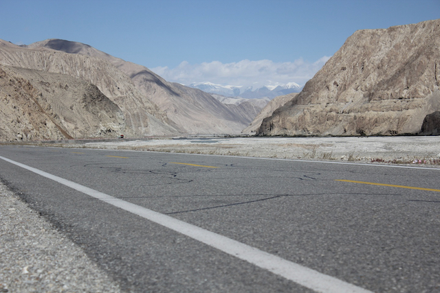
The Chinese Moon Cake holiday has given us an additional day in Kashgar, creating an opportunity to experience the world’s highest international paved road – the Karakoram Highway. The name stirs romantic images of intrepid, often dangerous, travel on the open road through some of the world’s most beautiful mountains. It took more than twenty years to build – at the cost of a thousand lives. The iconic 1300 km road skirts the Tajik border as it weaves from Kashgar through the 4700 metre Kunjerab pass into Pakistan. After hugging the Indus River for a while, the route drops among the spectacular peaks of the Hunza valley to Abbottabad. Sadly we won’t be going all the way – but just tasting the start of this tarmac trip to the heavens will leave some of us wanting to sign up for WF’s Karakorum Adventure!
Our plan is to drive for four hours or so, elevating to 3600 metres to lake Karakul. After the haze of the last couple of days in Kashgar, the mountain gods bless us with a clear day for our drive. After an hour the city is well behind us, now the overhead tangles of communication wires are the only concession to modern life. A security check reminds us we are 200 km’s from Pakistan and less than a hundred from Tajikistan. The strategic importance of seemingly barren landscapes often makes them flashpoint for political jostling, smuggling and banditry. We stop to photograph the bare red mountains already glowing in the morning sun. Huge channels from mudslides converge on the highway from either side; a reminder that roads aren’t supposed to be here. Soon we are gazing in awe of brilliant white peaks piercing a cloudless azure sky. Each corner we twist around seemingly reveals even higher, more beautiful peaks. It’s the sense that something so beautiful can be so dangerous that attracts man to battle with nature to reach the summits.
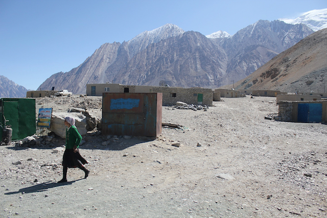
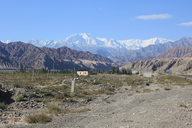
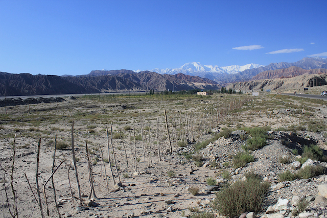
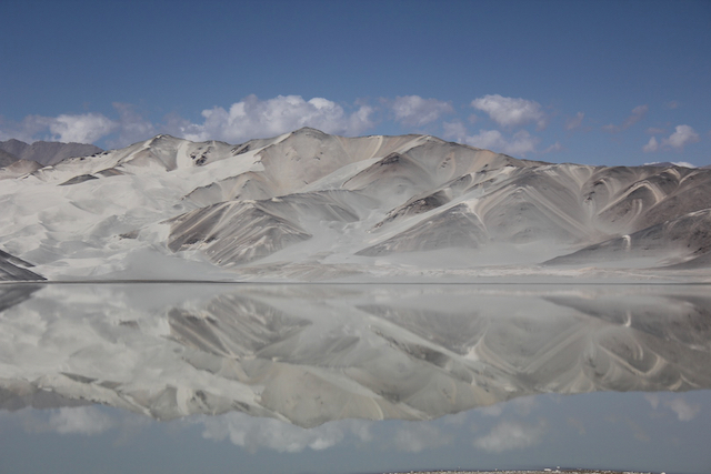
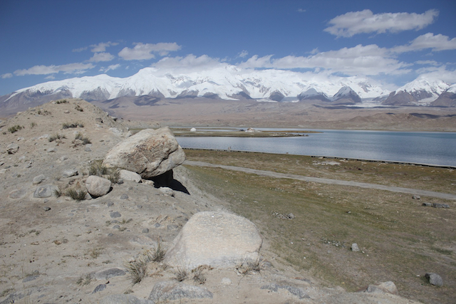
The region is home to around forty thousand mountain hardened Tajiks, whose nomadic lifestyle has been preserved in this wild beauty. Their sheep and goats hoover around the rocks looking for sprouts of greenery. A few mud brick buildings offer rudimentary comfort to those seeking shelter. Higher up the highway glacial melt water provides the lifeblood for the plateau’s vegetation, tempting shaggy yaks up here to to graze. An icy grey river gushes beside us, feeding mud brick villages. Before we reach our destination we stop at lake Bulongkul. A perfect reflection on the surrounding mountains is mirrored in the stillness of its turquoise waters.
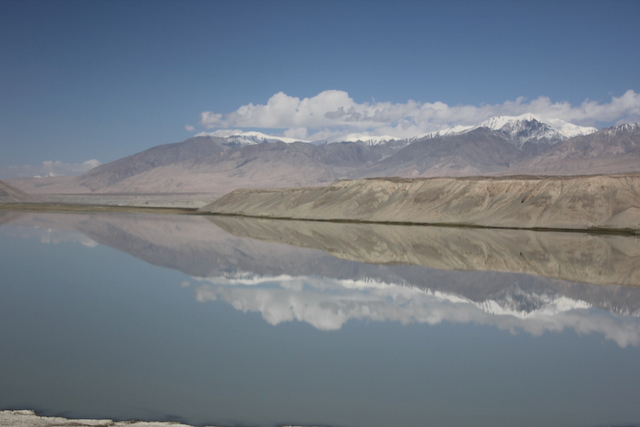
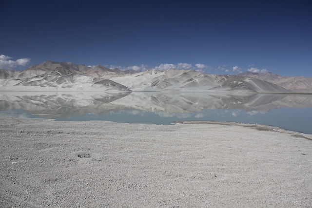
Finally we arrive at Karakul; ‘black lake’ – the highest lake on the Pamir plateau. It nestles neatly where the Pamirs meet the other great range of our trip, the celestial Tian Shan. The warm rays of the sun pierce the surface of the lake, creating a dazzling spectrum of green and blue hues. Clouds idle by the permanently snow-clad summit of Muztaghata (7546m) and the sacred peak of Mt Kongur (7611m), providing a heavenly backdrop to one of my most memorable picnics!
In three months conditions will deteriorate sufficiently for the road between China and Pakistan to close for winter. The snow-covered tracks of the Karakoram Highway will once again be left to the Tajiks and Kyrgyzs, whose nomadic traditions transcend those of their modern mobile invaders. I can only hope a similar story plays out in Kashgar between the Uighurs and Han.
Tomorrow will be our ‘The Longest Day’, when I’ll have the ‘hardship’ caveat from the Oxford definition of Odyssey ready to use. We will add another 450 kilometres and three more heavenly passes to our current Silk Road tally of 780 km’s as we travel from Kashgar to Osh in southern Kyrgyzstan.

